Powder Project Logo

A nice alternative to the crowded main run with snow-loaded gullies and tight tree skiing near the bottom.


Your Rating: Rating Rating Rating Rating Rating      Clear Rating
Your Difficulty:
Your Favorites: Add To-Do · Your List
Zoom in to see details
Map Key

0.5

Miles

0.8

KM

Ski Line

11,251' 3,429 m

High

10,420' 3,176 m

Low

0' 0 m

Up

831' 253 m

Down

33%

Avg Slope (18°)

38%

Max Slope (21°)
Type: Backcountry or Sidecountry
Access dependent on how fast snow plows can clear to the trailhead. Hidden Valley is only closed after massive storms.

Overview

A great view of the Mummy Range from the top, a relatively easy ascent, although GPS helps to find the best skin track above Trail Ridge. The skiing starts in an open gully, tightens up, and steepens before heading into the trees where the slope angle lessens but the trees become tighter. Should not be skied without a lot of coverage, MANY DOWNED TREES.

Need to Know

There are restrooms at the bottom (never used them so I don't know if they're open mid-winter) and an active sledding hill here so straight-lining through the bottom part is a big no-no.

Description

This alternative to the main runs at Hidden Valley is fun and can give you some nice solitude if you time it right. Start with the main ascent (follow the skin tracks to the right side of the sledding hill). You'll cross a small creek and pass an avalanche beacon practice park on your right.

Continue until running into an unsigned junction between what used to be the Aspen ski run back in the '90s and your ascent route. Take a left and skin up this old ski run, which now features many new growth trees, to the top of Lower T-Bar. Take a right and continue to Trail Ridge. Take another right and ascend up to roughly 10,250-10,300 feet. There are a ton of skin tracks threading the woods above you but it's easiest to do a bit of traversing on Trail Ridge before winding uphill. Note the elevation or the GPS coordinates of when you hit Trail Ridge, it'll help you on the way back. For those without this gear, note a yellow 25 mph sign about 50 yards below where you hit the road.

Skin up Trail Ridge Road for 0.25-0.5 miles. Once you find a suitable path, travel uphill (left) through thick trees until they lessen; take stock of where you are. If you end up at the bottom of a steeper gully, climb it, if you end up at the bottom of a wide-open bowl start veering left. The wide-open bowl (known as Big Basin) is another run in the area. If you're in the trees for more than 30 minutes with no open terrain, take a hard right until it opens up.

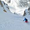
Orgasm Alley is separated from Big Basin by a line of stout pine trees that create significant snow-loading on their east side. That east side is a diagonal, rising gully that constitutes the majority of Orgasm Alley. Rise as high as you can, clip/strap in, and descend. The run is fun, well-defined and the tree skiing is challenging.

You can repeat the line when you hit Trail Ridge or head to Big Basin.

Bonus: If you're in a one-and-done mindset, when you get to Trail Ridge, conserve some speed, hang a right, and glide back to where you first emerged on Trail Ridge. Use GPS, elevation, or sight the 25 mph sign and take a left into the trees about 50 yards above it. From here, you can take a straight shot down the Lower-T Bar ascent, which is a nice way to finish the run.

History & Background

The name comes informally from skiers who frequented Hidden Valley when it was open. The run was a little out of the ski boundaries and tended to hold snow a lot longer than other areas. I ran across the name while reading Mark Kelly's Guide to Skiing in Rocky Mountain National Park.

Contacts

Shared By:

Timo Holmquist

Trail Ratings

  1.7 from 7 votes

#841

Overall
  1.7 from 7 votes
5 Star
0%
4 Star
0%
3 Star
29%
2 Star
14%
1 Star
57%
Ski Line Rankings

#344

in Colorado

#841

Overall
43 Views Last Month
382 Since Jan 25, 2022
Difficult Difficult

0%
0%
0%
33%
33%
33%

Photos

This is the top of Orgasm Alley, you can add a couple hundred feet if coverage is good. The alley starts to the right of the dark clump of pine trees and descends slightly left (not the fall line) until reentering the trees.
Jan 25, 2022 near Estes Park, CO
loading

Weather


Current Trail Conditions

Unknown
Add Your Check-In

Check-Ins

Jan 22, 2022
Devon Bailiff
Good coverage up top, fun tight trees on the way down. 4.5mi — 2h 15m
Welcome

Join the Community! It's FREE

Already have an account? Login to close this notice.